If you happen to
be traveling through the southeastern region of Armenia and on your way to see
the world famous Tatev Monastery consider making a small detour and visit the
city of Khndzoresk. “Khndzor” means
apple in Armenia but “Khor Dzor” means deep gorge in Armenian as well. Eventually they merged the two and ended up
with Khndzoresk and that’s how it got its name.
It’s just a few minutes outside the city of Goris and it’s like going
back in time to see how our ancestors have survived the elements. Just 8 km east from Goris off the main
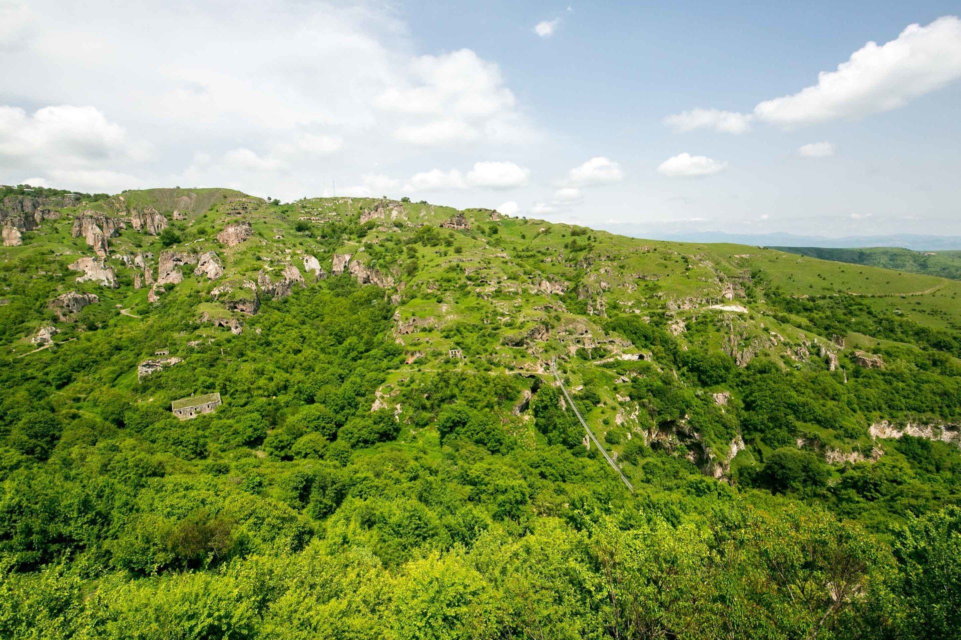
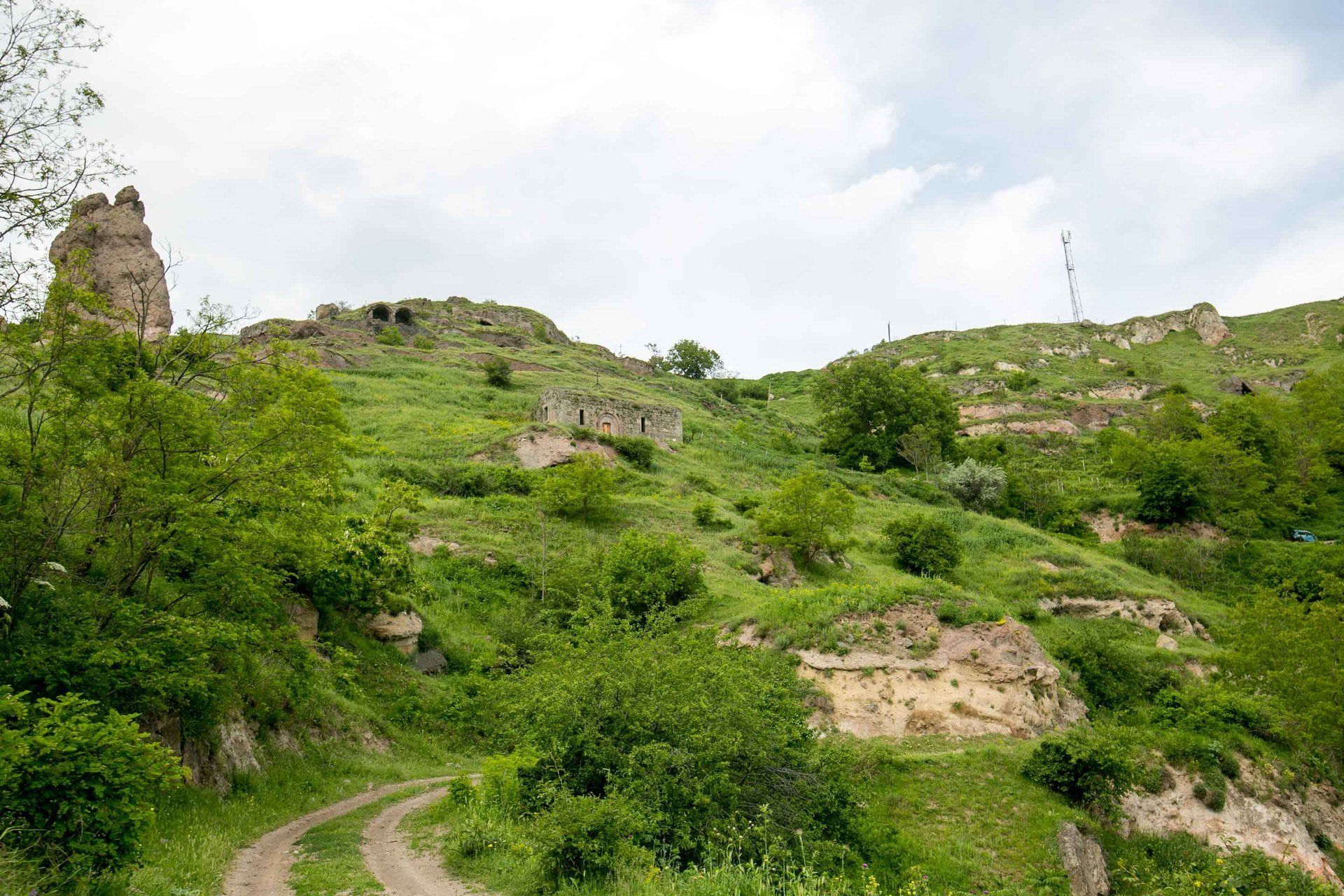
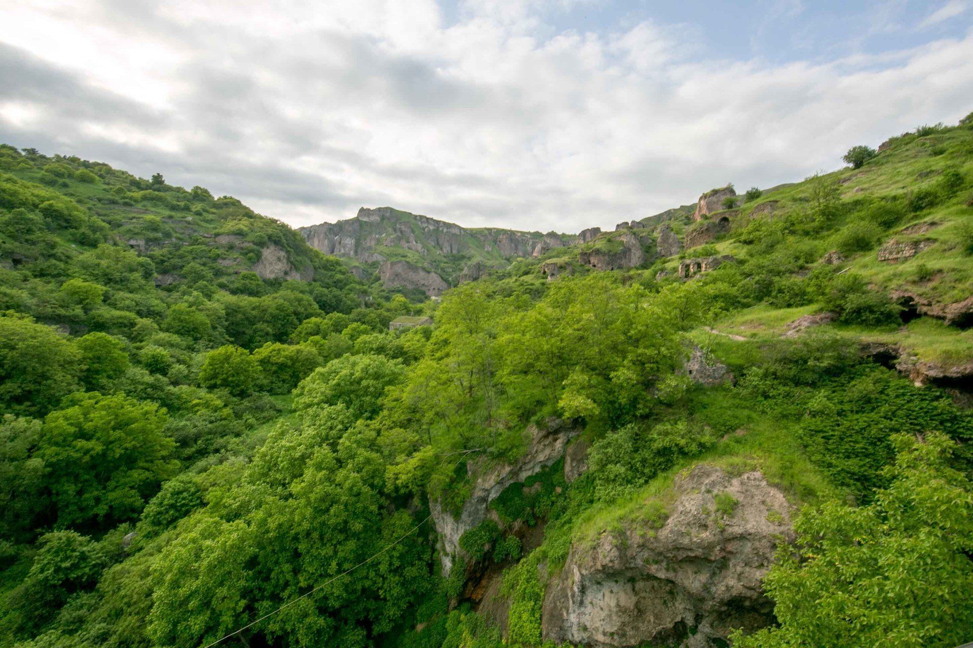
highway is one of the most interesting sites in southern Armenia. Known as the City of Caves, an entire
community once thrived here along the steep slopes of Khor Dzor or Deep
Gorge. As many as 10,000 inhabitants
carved or inhabited caves along both sides of the gorge. Nature has pretty much-covered the west side
of gorge and thus hiding the caves but the other half is accessible and still
visible.
Living in caves
is as old as time for humans being since it offers protection from the weather,
dangerous neighbors, and from animals but the Soviets decided to move the
people out of this area in the 1950s since it was deemed uncivilized. The last family moved out of these caves in
1974. Since there were not many flat
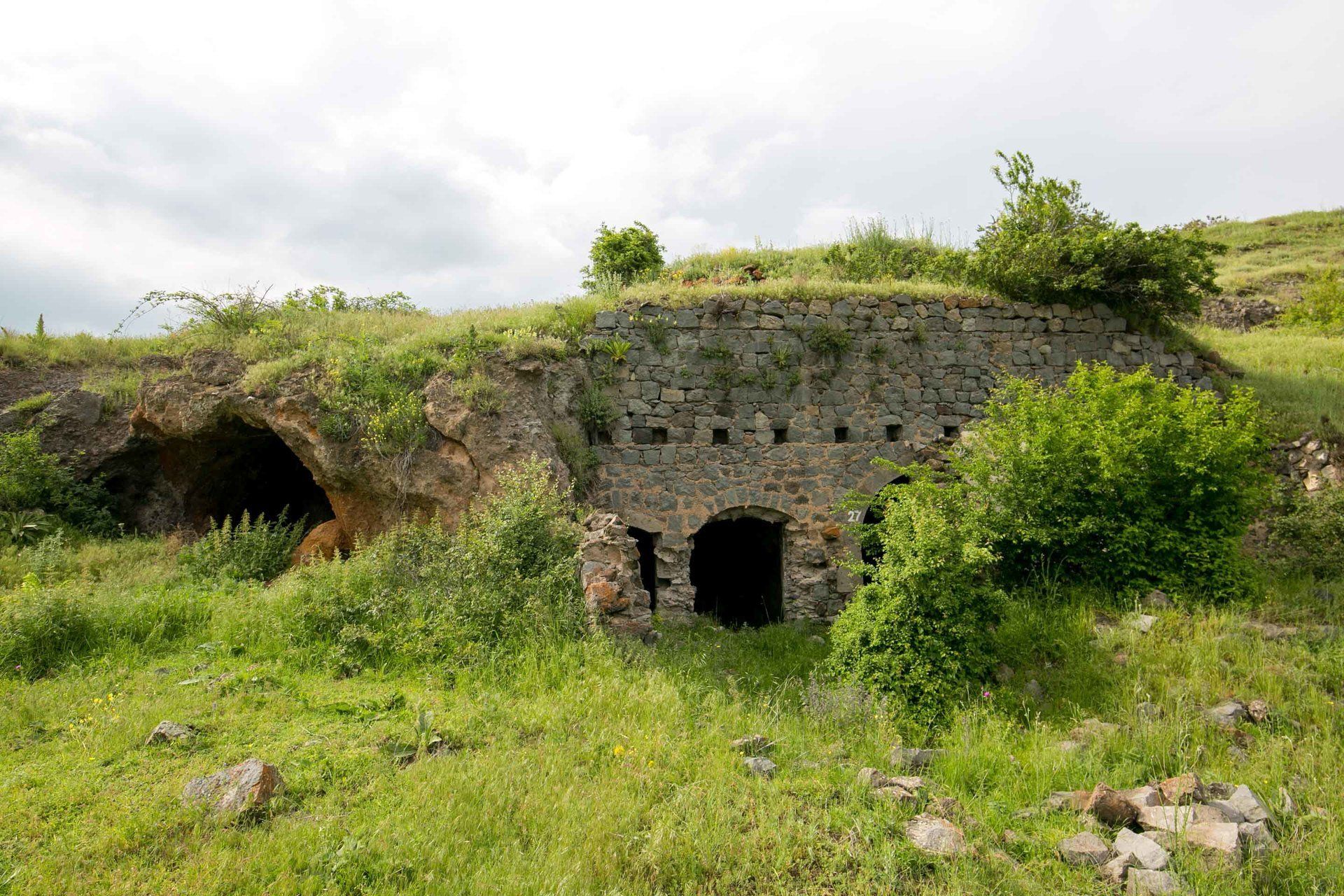
areas here many of the caves were stacked on top of each other. One’s person floor was another person’s
roof. You can still see some of the
caves still have long wooden logs wedged at the entrance of the cave. A rope would then be tied to the log and that
is how they got up. Some of the caves go
as high as 25 meters and offered great security from oncoming threats. In 1913 there were 9 districts within the 3 kilometer long settlement and roughly 1,800 “houses”, 27 shops,
and 7 functioning schools.
I visited
Khndzoresk in May so the weather was great and the background was alive with
the forest. I booked a tour guide from
Goris Tours and Ara, my amazing tour guide, took me everywhere in
Khndzoresk. The interesting thing about
Ara is aside from being born in this area, his father was born in Khndzoresk
too! I mean, how often can you say that
your father was born in a cave?!?!
Anyways, after leaving the main highway you take a long dirt road and
follow the signs until you reach the gorge.
You’ll see some souvenir and places to eat and from there you begin to
take the staircase below. Be prepared to
do a lot of walking!
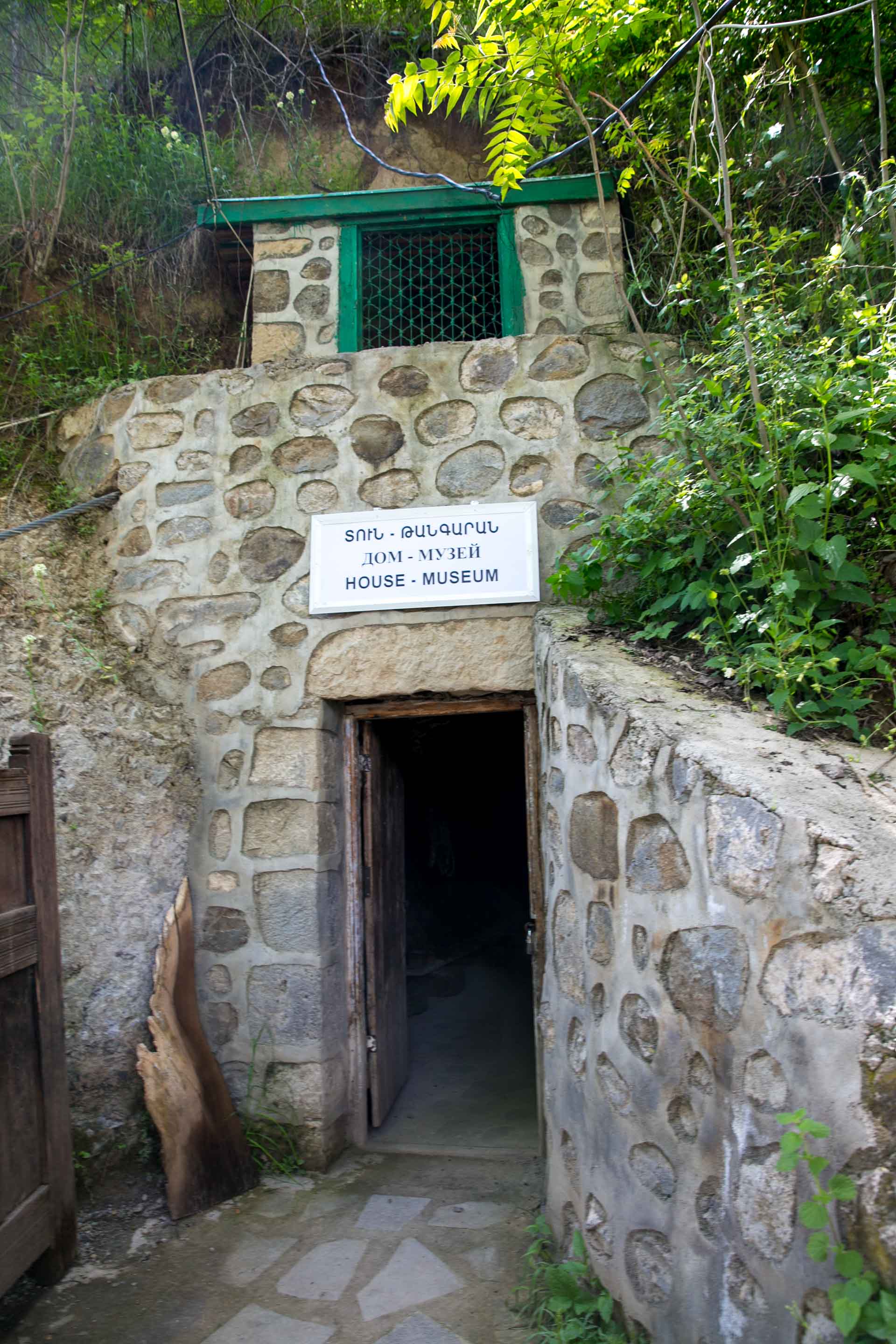
Once you get
below to the bridge you come across a museum that shows what the life was like
back then. Very rustic and basic living is
evidenced here and the community was able to thrive here. The caves are simple and some even have
chimneys too. The price to enter was 500
dram or slightly over $1. My favorite
part of the museum was seeing an old vat they used to distill and the old
butter maker. There are also some old
photos depicting life of when it was flourishing. There’s a small restaurant next door in case
you want to grab a bite for the hike ahead.
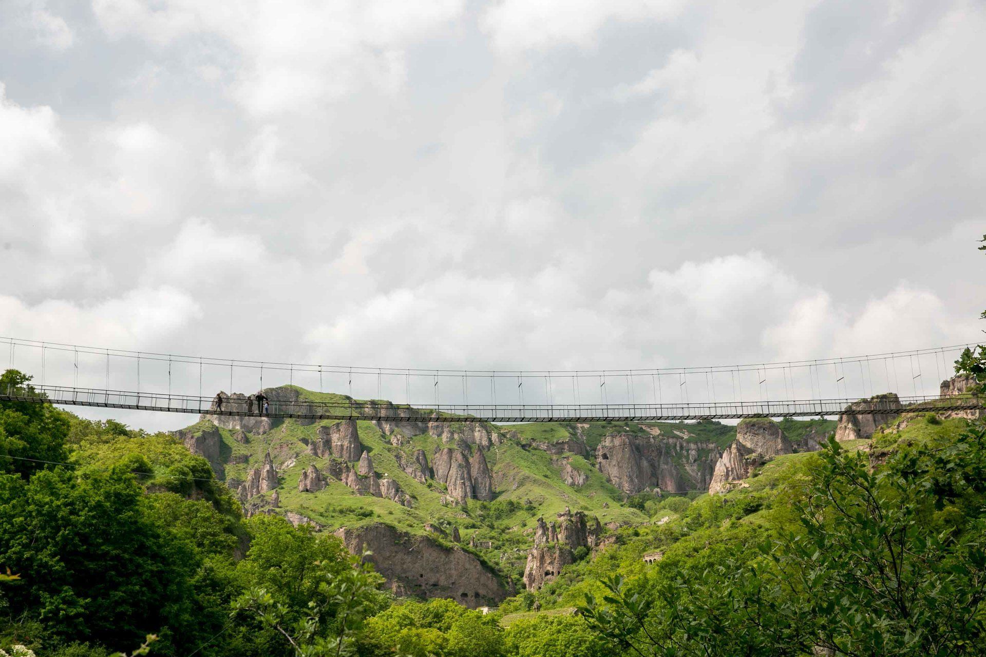
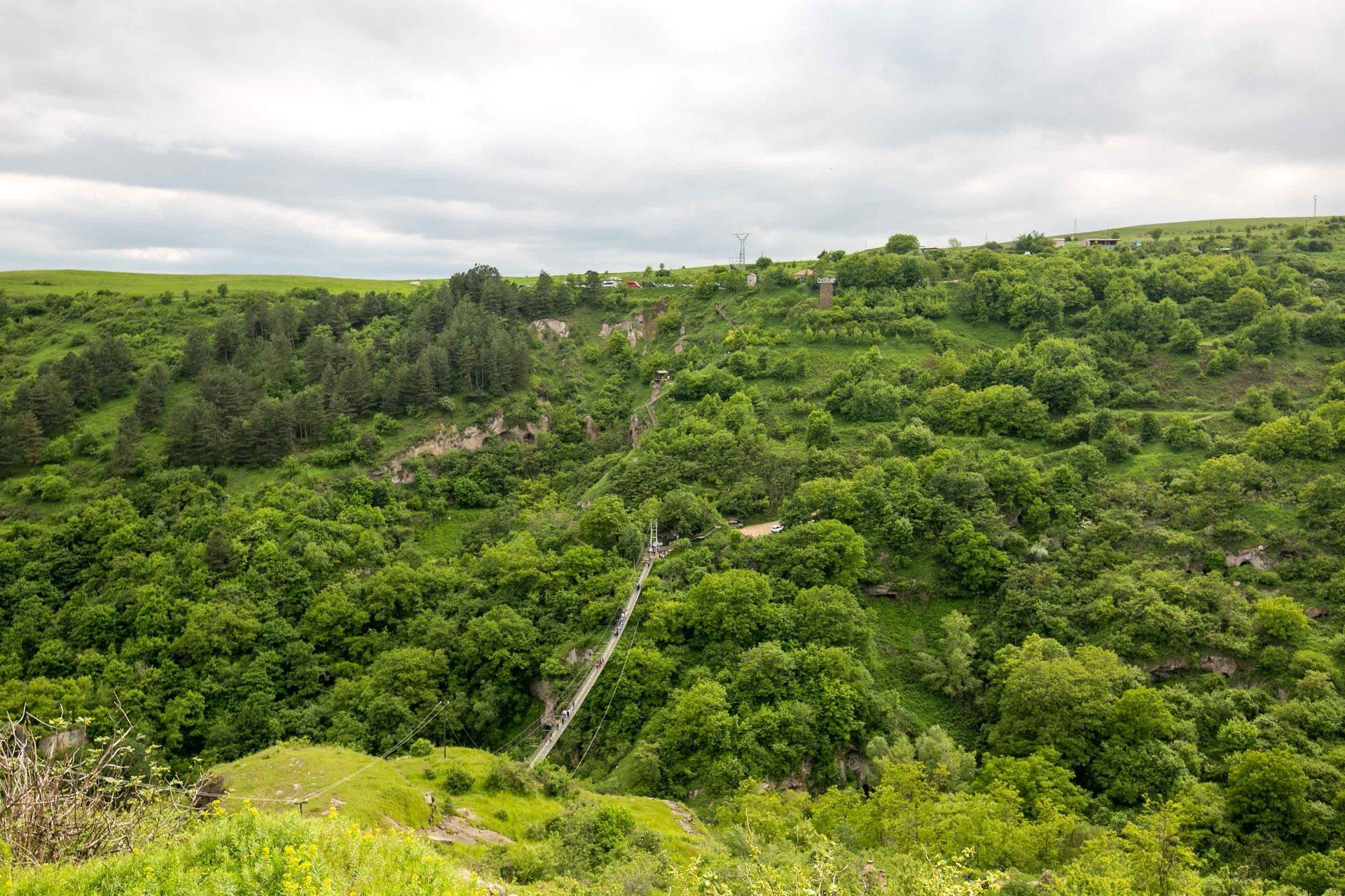
After visiting
the museum and getting a snack you must cross the swinging bridge. The story behind this swinging bridge is
quite interesting too. One of the unique
traits about Armenian village life is that if someone leaves the village and/or
becomes quite successful, he or she will return and make a valuable
contribution to the community. I’ve seen
this before outside my city of Gyumri where a wealthy businessman from a
village called Bandivan completely financed a new church. I only knew of this because I knew the
painters/artists who were commissioned to decorate the interior of the church
told me. As with this case in
Khndzoresk, a successful businessman by the name of Zhora Aleksanyan decided to
finance the completion of the bridge from one side of the gorge to the other to
honor the memory of his parents and help the youth know their past. According to Ara, the funny thing is that he
did this without the blessing and knowledge of the local authorities. One of the main concerns was that how could a
private person just make a bridge that the public would use without it going
through rigorous inspections and regulations.
After a public outcry, local officials were sent out to test the
stability and safety of the bridge and later determined that it was 10 times
stronger than the local regulations required!
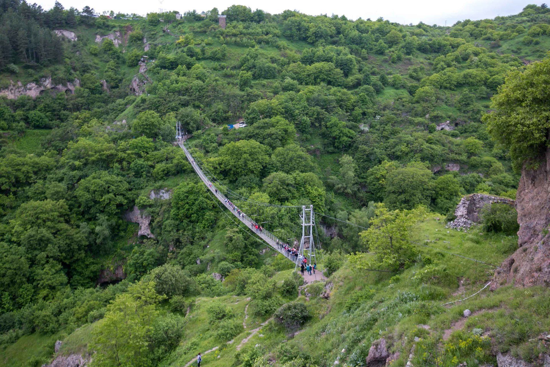
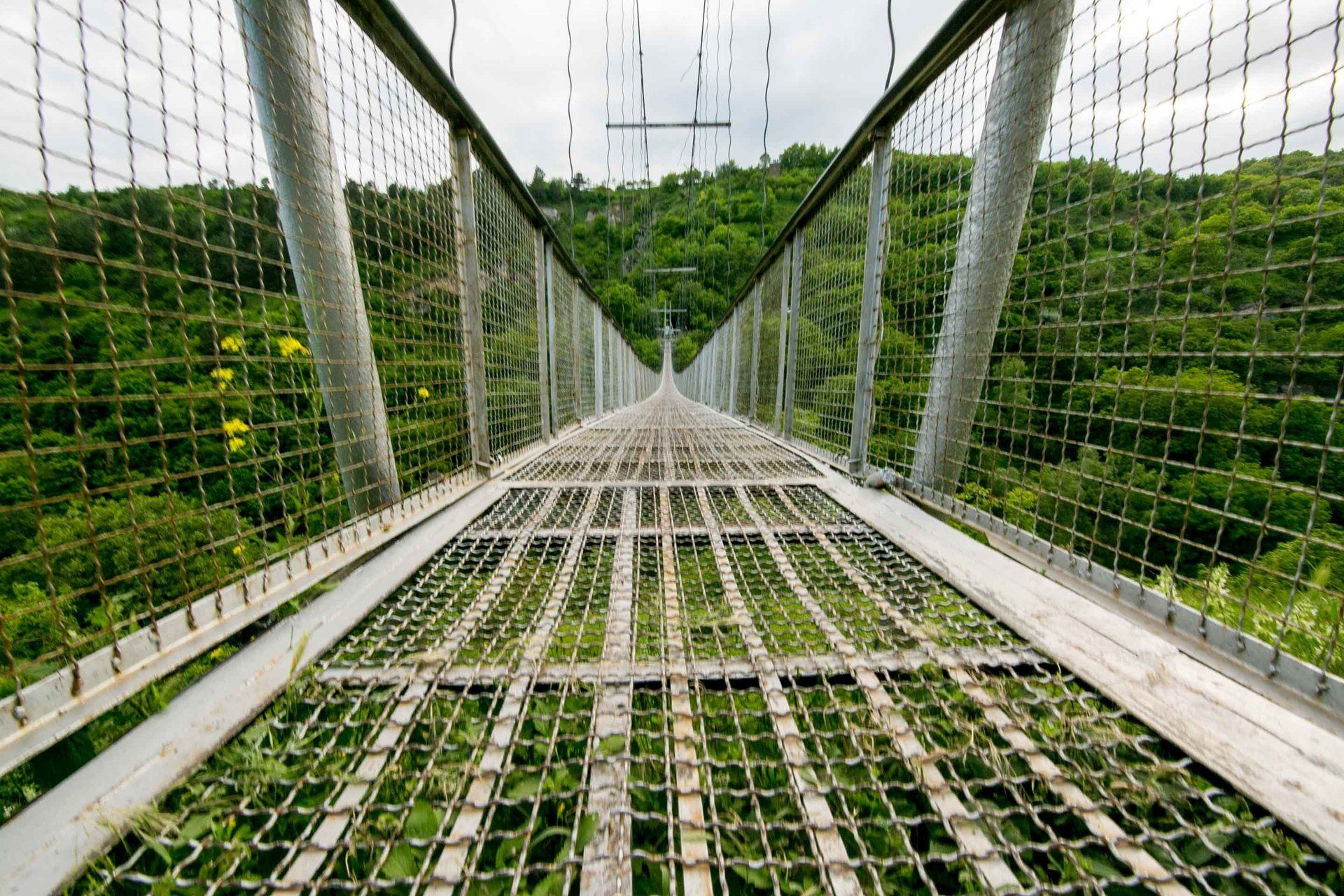
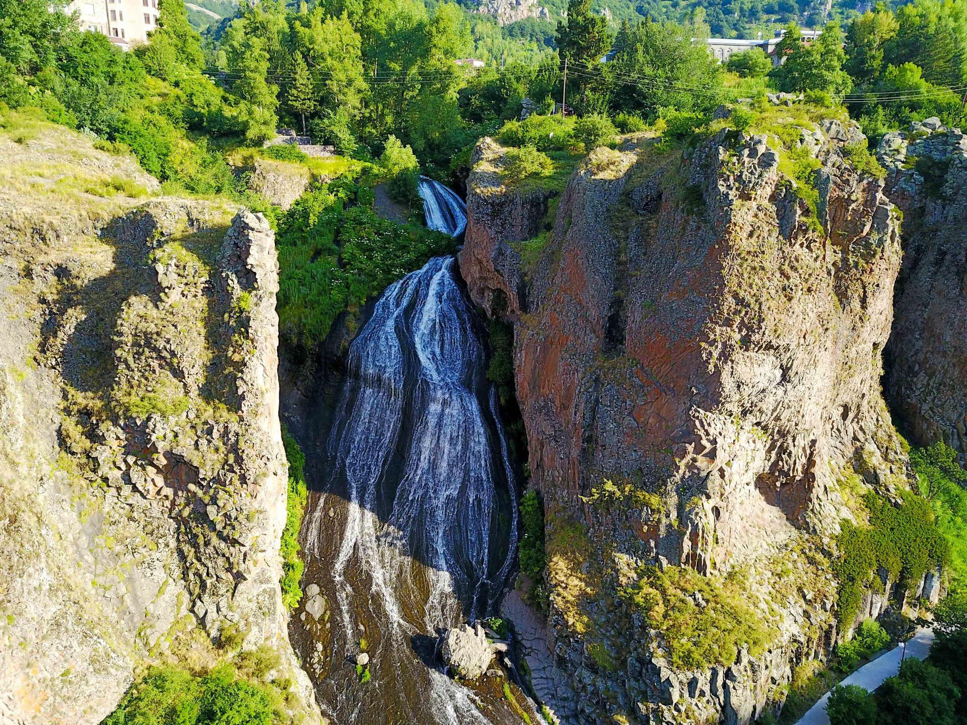
The swinging
bridge is 160 meters long, 1.5 meters wide, stands 36 meters above the ground, and
weighs in at 14 tons and made its public debut in 2012. The bridge was
constructed by the residents of the village and claim they did it by hand and
without the aid of any heavy machinery.
The locals also claim that the bridge can “hold” up to 700 people! If you’re scared of heights like I am, it
will scare you, but I did it anyways because the view of the gorge below and
the entire area is spectacular and worth it.
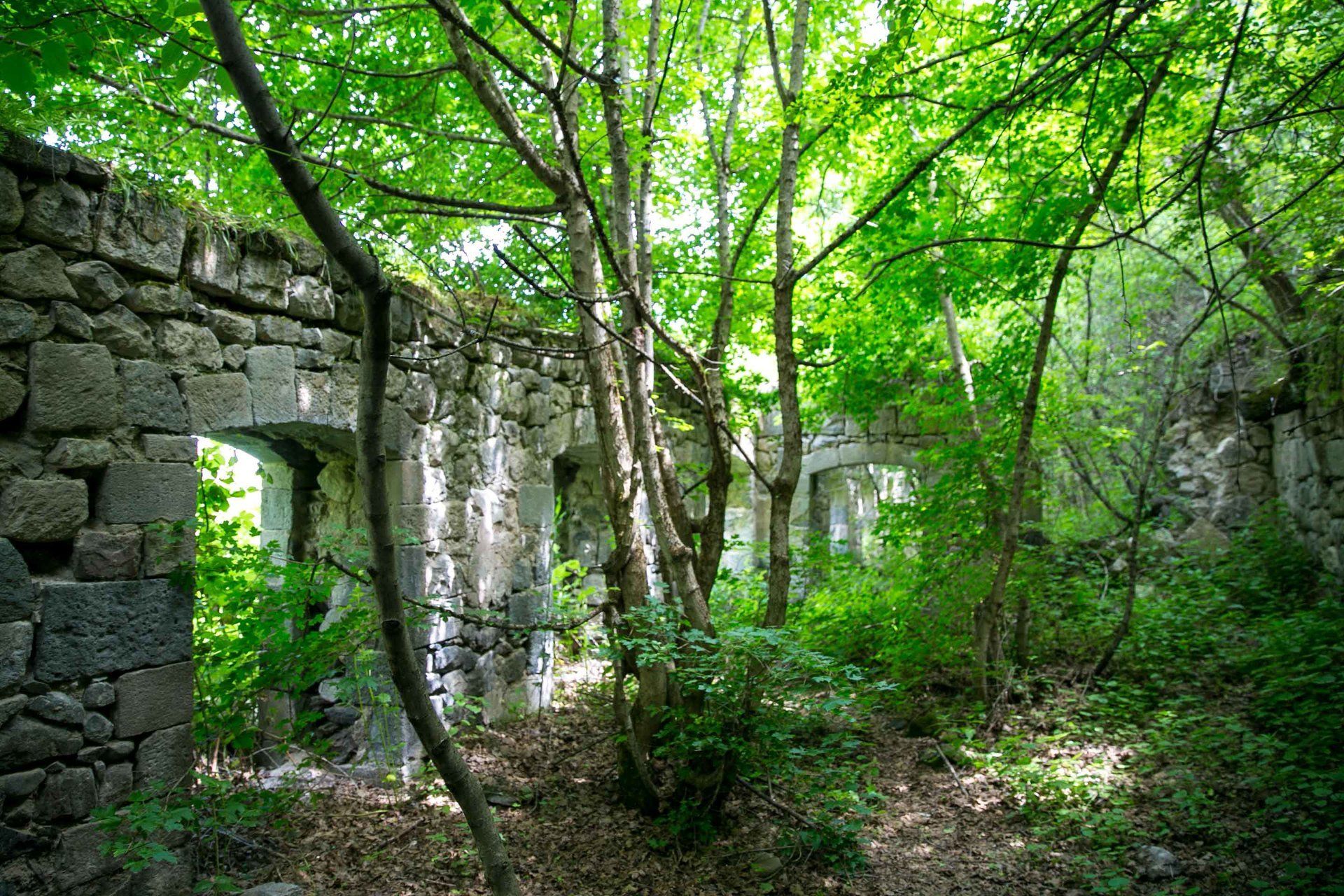
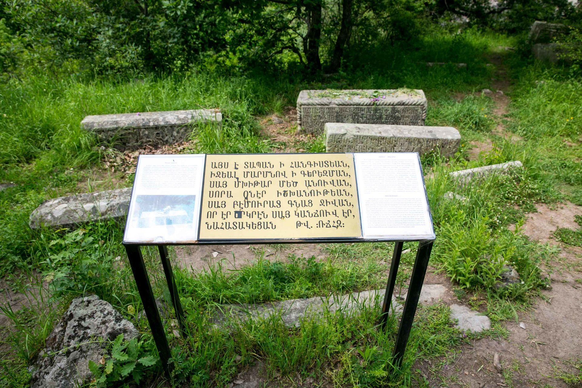
The first place
that Ara took me to was the old school and the tomb of Mkhitar Sparapet, the
Armenian national hero who was credited for many military victories over the
Turks and Persians in the Russo-Persian Wars of 1722-1723, and was killed on
his way to Khndzoresk. This area was
under renovation so we had to walk past the crews who were maintaining the
trails. The area will give you a good
view of the bridge and is just about 20 meters from below. Next we made our way to crossing the swinging
bridge. It was a little crowded when we
went because it was officially the first day of summer since many kids just
finished their “last bell” at school the previous day. I always smile because of my ethnicity in
Armenia, I usually get stared at and will often get asked to get my picture
taken with them. Some kids asked me for
a photo but I only agreed if I could take a picture with my camera too. Along the bridge you have a great view of St.
Hripsime Church located in the northern section of Khndzoresk.
After crossing the bridge Ara and I turned left
and headed to the northern part of the gorge.
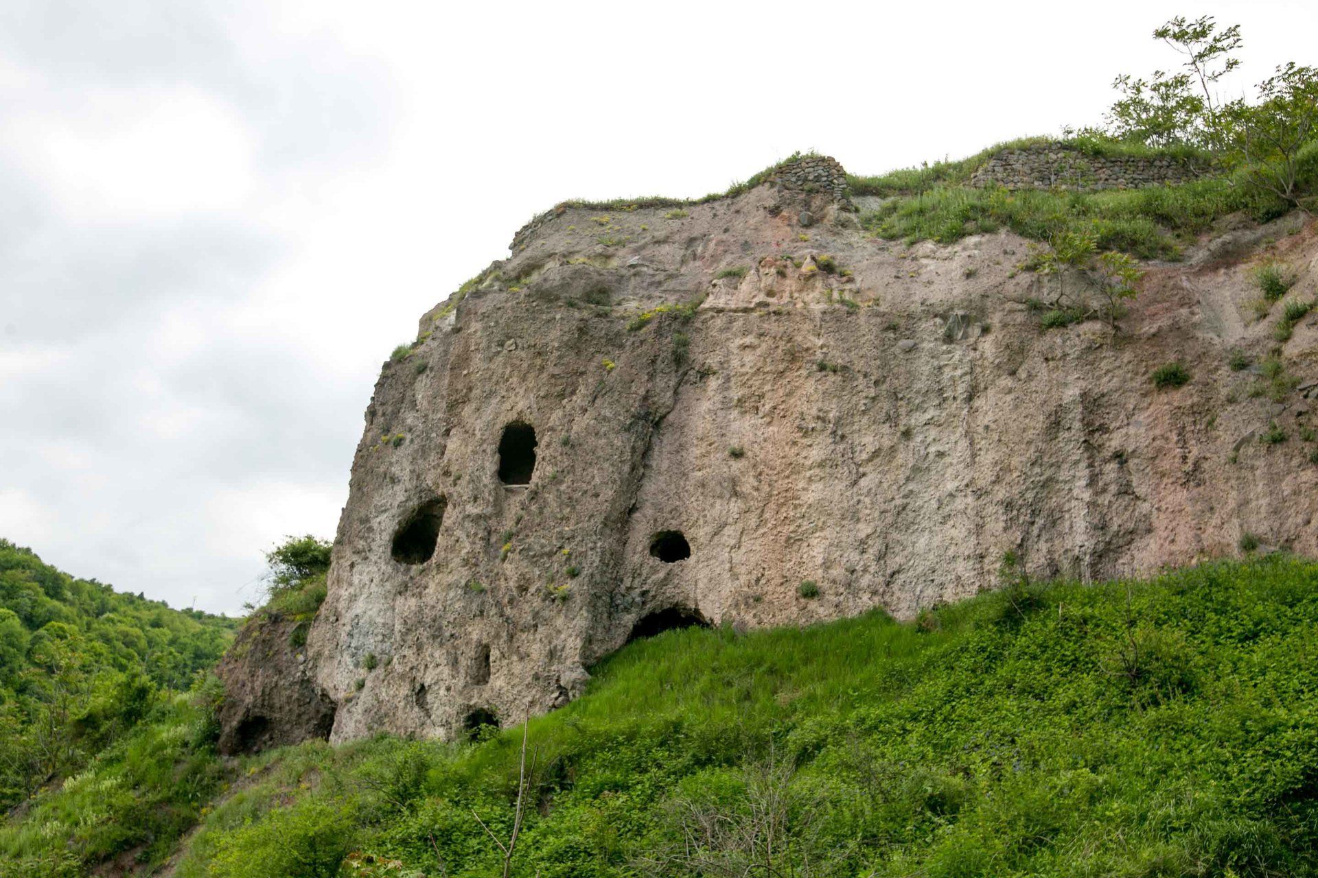
Immediately, you are near some caves that were most likely used for
livestock. Caves are everywhere and
stacked on top of each other too. Every
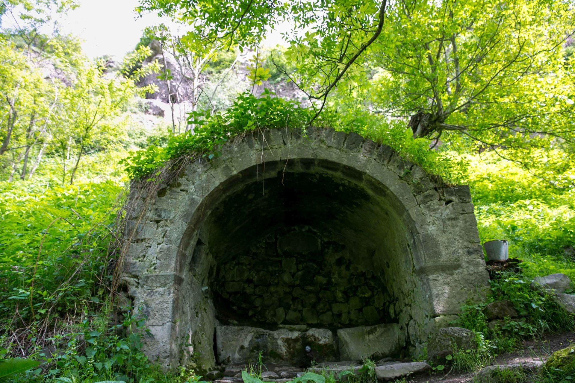
now and then you will come across a natural spring to refill your water
bottle. One of the more famous landmarks
is the Nine Children water fountain.
Local legend states that a woman named Sona, a widow and mother to 9
deceased children after an attack, had the water fountain built in her honor by
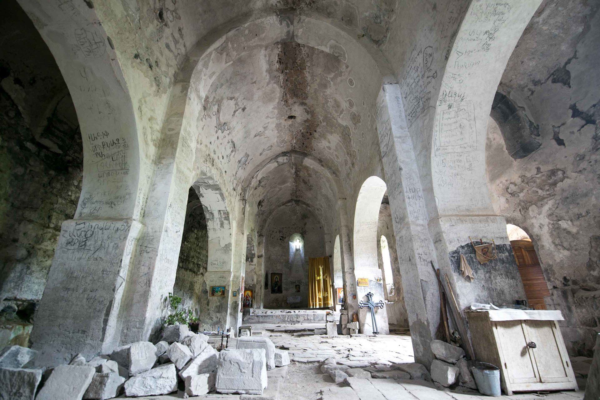
her father. Khndzoresk has 4 churches
and the first one we were going to see was the St. Hripsime Church that was
easily visible from the bridge.
Constructed in the 17th century it’s most noticeable from the
distance due to the amount of grass growing on its roof. Inside you can see that there are pieces of
the church lying everywhere inside. I
forgot to ask if the locals still hold a service there because it was in
relatively decent condition. The other
three churches are the Tadevos Church, Anapat school-church, and the Old Cave
Church.
After the church
we headed north and the caves that were built extremely high off the ground can
be seen here. The photos from the museum
of families living in the higher caves were taken here. On our hike we met a local volunteer who
lives nearby and found out he helps maintain the trails. His name was Vardan and he was extremely
photogenic and nice. I remember him
vividly because his friendly donkey and puppy accompanied him. From here we headed east towards the top of
the gorge and although the terrain got tougher to hike, the views got more
spectacular. It turns out this area is
extremely popular during vacation time and on national holidays this placed is
packed with people coming up for a picnic to enjoy the view. There were also a lot of cows just grazing
along the side of the gorge too.
Afterwards, we
started heading to the southern end of the village and stopped by the old
cemetery that was littered with headstones everywhere in no particular
order. The view was great and it was
much easier to walk to since it’s not as steep.
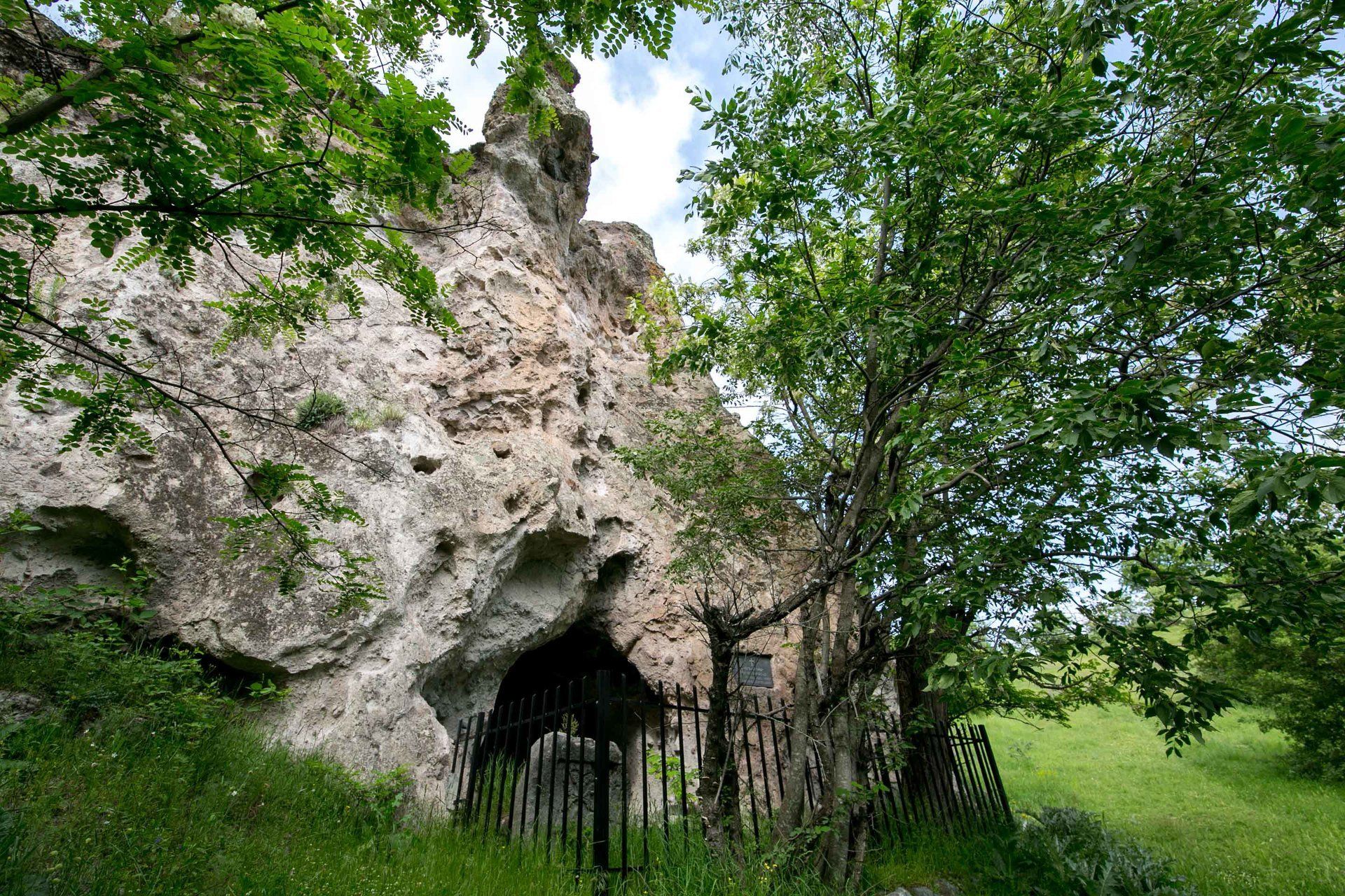
At the southern end you’ll come across the Old Cave Church and inside
you’ll see a khachkar or cross stone that was built in 306 AD! It took us nearly 2 hours to hike the entire
village because I wanted to take my time in taking photos and poking around the
numerous caves but it can be done much quicker.
Make sure you have good hiking boots with a good grip because of the
terrain.
Due to the size and scope of this area I used my wide lens most of the time. This place is so interesting and beautiful I tried to capture as much as I could so I didn’t use my smaller lenses at all. There’s no entrance fee or time restriction of when to visit so take your time to explore this ancient city. I was traveling solo and went with my tour guide Ara from Goris Tours and on a tight schedule so it was easier this way. I’ve been to Cappadocia in Turkey and it dwarfs Khndozoresk easily. Cappadocia was a thriving metropolis underground as well as above in the caves and had a population of nearly 100,000. There are many similarities these two ancient cities share and that’s why it’s fair to call Khndzoresk Little Cappadocia. Add this to your itinerary if you plan on visiting southern Armenia because it’s worth checking out and gives an understanding of Armenia’s history too.
Happy traveling!!!