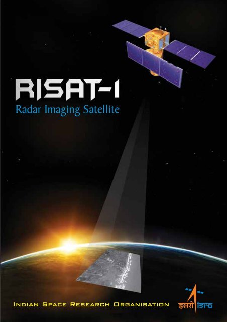
RISAT-1. Radar Imaging Satellite
RISAT-1. Radar Imaging Satellite
RISAT-1. Radar Imaging Satellite

Create successful ePaper yourself
Turn your PDF publications into a flip-book with our unique Google optimized e-Paper software.
<strong>Radar</strong> <strong>Imaging</strong> <strong>Satellite</strong><br />
Indian Space Research Organisation
<strong>Radar</strong> <strong>Imaging</strong> <strong>Satellite</strong><br />
IRS satellites so far have been<br />
designed to provide data in the<br />
visible and near infrared region of<br />
electro-magnetic spectrum. The<br />
collection of data in these bands by<br />
the electro-optic imaging sensors<br />
has a limitation in the presence of<br />
clouds and fog, as the<br />
electromagnetic radiation in these<br />
wavelengths cannot penetrate the<br />
clouds/fog. India being a tropical<br />
country has a perennial cloud<br />
presence during kharif season (July<br />
October), which is the prime<br />
monsoon period in the country,<br />
limiting seriously the visible and<br />
near IR data from satellites for any<br />
meaningful applications. This<br />
season is very important from<br />
agricultural production point of<br />
view and the country is also prone<br />
during this season for disasters<br />
such as flood, cyclones and storm<br />
surges. Besides, the visible & near<br />
IR data can only be obtained during<br />
daytime as it depends on sun's<br />
reflected radiation for data<br />
collection. It is where the use of<br />
microwave remote sensing data<br />
becomes essential. Microwave data<br />
such as Synthetic Aperture radar<br />
(SAR) has the innate capability of<br />
collecting data in day/night and all<br />
weather conditions as it operates in<br />
microwave bands for which the<br />
atmosphere is transparent. With<br />
the known radar backscatter<br />
sensitivity to soil moisture and<br />
surface roughness, SAR has become<br />
an important component in many<br />
applications, either in a stand-alone<br />
mode or in complementary/<br />
supplementary to electro-optical<br />
sensors, and has been extensively<br />
used in areas such as agriculture,<br />
oceanography, forestry, geology and<br />
hydrology.<br />
<strong>Radar</strong> <strong>Imaging</strong> <strong>Satellite</strong><br />
(<strong>RISAT</strong>-1), a new class of remote<br />
sensing satellite distinct from the<br />
established IRS class, is being<br />
developed by Indian Space Research<br />
Organisation (ISRO) as its first<br />
satellite imaging mission using an<br />
active radar sensor system. <strong>RISAT</strong>-1<br />
carries a multi-mode C-band<br />
Synthetic Aperture <strong>Radar</strong> (SAR) as<br />
the sole payload. The <strong>RISAT</strong> Mission<br />
is envisaged to augment the<br />
operational remote sensing<br />
programme in the country mainly<br />
enhancing agriculture and disaster<br />
support related applications. <strong>RISAT</strong><br />
is slated for launch using PSLV by<br />
during the second half of 2008.
Mission<br />
The primary mission objectives of <strong>RISAT</strong>-1:<br />
• To design, develop, launch and operate a space based SAR mission<br />
operating in multi-polarisation, multi-imaging modes with the mission life<br />
of atleast 5 years.<br />
• To establish ground segment to receive, process and provide SAR data<br />
products and services in an operational manner to the user community<br />
• To enable integrate with the existing applications and help develop newer<br />
applications.<br />
<strong>RISAT</strong>-1 will be launched into a polar sun synchronous orbit of 610 kms with<br />
the local time of equatorial crossing at 6.00 AM in descending node, as SAR<br />
does not need sun illumination for the target. The choice of this orbit gives<br />
advantage in terms of maximizing the power generation, with lesser<br />
complexities in solar panel tracking arrangements and power system<br />
management, besides simplifying the thermal management. This orbit also<br />
meets the basic repetitivity cycle requirement of around 25 days for the<br />
medium resolution (25m) mode of SAR.<br />
EARTH SENSOR<br />
STAR SENSOR<br />
SOLAR PANEL<br />
THRUSTERS<br />
SAR ANTENNA<br />
The major orbit parameters<br />
Altitude – 610 Km, polar, circular<br />
Inclination – 97.844°<br />
Local time of pass – 6.00 AM
Modes<br />
Coarse Resolution ScanSAR<br />
Mode (CRS)<br />
Medium Resolution ScanSAR<br />
Mode (MRS)<br />
Fine Resolution Stripmap<br />
Mode-2 (FRS-2)<br />
Fine Resolution Stripmap<br />
Mode-1 (FRS-1)<br />
SAR Payload<br />
<strong>RISAT</strong>-1 will carry a C-band<br />
Synthetic Aperture <strong>Radar</strong> (SAR) catering<br />
to the needs of various applications<br />
stated elsewhere. It is well known that<br />
radar backscattering depends on sensor<br />
parameters such as frequency,<br />
polarisation, and incidence angle as well<br />
as on the target parameters such as<br />
dielectric constant, roughness and<br />
geometry. The <strong>RISAT</strong>-1 SAR sensor will<br />
be based on active phased array<br />
antenna technology, which will provide<br />
required electronic agility for achieving<br />
multimode capability. This state-of-theart<br />
technology is expected to survive<br />
technological obsolescence for long<br />
time to come and is upgradeable to<br />
other frequency bands in succeeding<br />
missions.<br />
<strong>RISAT</strong> SAR will operate with basic<br />
0 0<br />
elevation beam-width of 2.9 to <strong>1.</strong>6<br />
over a total ground distance of 400 kms<br />
starting from a stand-off distance of<br />
200 kms. Elevation beamwidth will be<br />
Resolution<br />
made to vary with pointing angles in<br />
order to achieve pointing independent<br />
swath of 30 kms and near constant<br />
optimum radar cross section<br />
performance. Fast beam pointing and<br />
beam width control in elevation<br />
direction is achieved electronically<br />
with the help of an active phased<br />
array antenna.<br />
The active phased array antenna is<br />
the heart of SAR payload. Essentially,<br />
active antenna consists of a printed<br />
dual polarized radiating aperture; dual<br />
channel Transmit-Receive (TR)<br />
modules comprising TR-RF, TR control<br />
and miniaturized EPCs; the control<br />
unit; and a signal distribution and<br />
calibration network. The RF and baseband<br />
system consists of feeder Solid<br />
State Power Amplifiers (SSPA);<br />
frequency generator; receiver; digital<br />
chirp generator; data acquisition unit<br />
comprising of high speed digitiser,<br />
BAQ and formatter; calibration switch<br />
matrix; and payload controller.<br />
2-4 look (depending upon pointing) 50 m<br />
resolution over a swath of 240 km in either<br />
single or dual polarisation imaging<br />
1-2 looks (depending upon pointing) 25 m<br />
resolution over a swath of 120 km in either<br />
single or dual polarisation imaging<br />
Single look 9-12 m resolution image over<br />
30 km swath in quad polarisation<br />
Single look 3-6 m resolution image over 30 km<br />
swath in either single or dual polarization
Modes of Operation<br />
100 km<br />
(UNQUALIFIED)<br />
100 km<br />
(UNQUALIFIED)<br />
608 km<br />
FRS1&2 MODE<br />
200<br />
km<br />
400 km<br />
(QUALIFIED)<br />
CRS MODE<br />
MRS MODE<br />
<strong>Radar</strong> <strong>Imaging</strong> <strong>Satellite</strong><br />
The active antenna consists of three<br />
panels each of 2m x 2m size, totaling<br />
6x2minall,andisdividedinto12tiles<br />
of 1m x 1m each. Front side of each tile<br />
has a grid of 24 x 24 radiation patches.<br />
Backside of each tile carries 24 T/R<br />
modules, their power supply modules<br />
and controllers. With the help of phase<br />
shifters in the T/R modules, the antenna<br />
beam can be steered in range direction.<br />
Output RF peak power of each T/R<br />
module is 10 watts and the noise figure<br />
of its receiver is 2 dB. The antenna has<br />
its own calibration network to cross<br />
check the performance of its various<br />
elements on ground and in orbit. Input<br />
signals to and output signals from TR<br />
modules are processed using RF and<br />
baseband subsystems. A chirped signal<br />
at 5.35 GHz, having a pulse width upto<br />
20 µ sec is fed to the T/R module for<br />
further amplification and transmission.<br />
The output of the receiver is filtered,<br />
digitised using block adaptive<br />
quantisation and sent to data formatter.<br />
The data from SAR is formatted and<br />
fed to RF transmitter. A solid-state<br />
recorder (SSR) is part of the baseband<br />
data handling subsystem. The payload<br />
data can be transmitted in real time<br />
mode or in playback mode.<br />
It is planned to transmit the SAR<br />
data, with 640 MBPS data rate using X-<br />
band down-link in QPSK mode. A phased<br />
array antenna with dual polarization is<br />
used to overcome the limitation of<br />
available bandwidth. The data rate for<br />
each polarisation is, thus, planned to be<br />
2 x160 Mbps. Data transmitter antenna<br />
will have onboard beam<br />
steering towards the<br />
ground station during<br />
data transmission.
Hardware Specification of <strong>RISAT</strong>-SAR<br />
Frequency<br />
Antenna Type<br />
Antenna Size<br />
Side Lobe Level<br />
Number of TR modules<br />
Pulse width<br />
Average DC Input Power<br />
5.350 GHz<br />
Microstrip Active Antenna<br />
6m (Along Flight Direction) x 2m (Cross Flight Direction)<br />
-15 dB (Azimuth), -18 dB (Elevation)<br />
576, each with 10 W peak power<br />
20 µ sec<br />
3.5 kW<br />
<strong>Imaging</strong> Modes FRS-1 FRS-2 MRS/CRS<br />
Chirp Bandwidth 75 MHz 37.5 MHz 18.75 MHz<br />
Sampling Rate 83.3 MHz 4<strong>1.</strong>67 MHz 20.83 MHz<br />
PRF 3000 Hz ± 200 Hz 3000 Hz ± 200 Hz 3000 Hz ± 200 Hz<br />
Quantisation<br />
2/3/4/5/6 bit BAQ<br />
MAX. Data Rate 556 Mbits/sec 564 Mbits/sec 142 Mbits/sec<br />
@ 6 bit BAQ (Single Pol.) 1112 (Single Pol.) 284<br />
Mbits/sec (Dual Pol.<br />
Mbits/sec (Dual Pol.)<br />
Specification of <strong>RISAT</strong> Antenna<br />
Size<br />
6m x 2m<br />
Frequency<br />
5.35 GHz ± 112.5 MHz<br />
Antenna Beamwidth 0.5° x <strong>1.</strong>5°<br />
Beam Scanning Elevation ±15°<br />
Gain at center frequency<br />
Gain Bandwidth<br />
Antenna Bandwidth<br />
44.5 dB<br />
<strong>1.</strong>0 dB<br />
225 MHz<br />
3 Panels with each panel size 2m x 2m<br />
Cross polarization<br />
Polarisation<br />
-23 dB<br />
Dual linear polarisation
Spacecraft<br />
Characteristics<br />
<strong>Radar</strong> <strong>Imaging</strong> <strong>Satellite</strong><br />
<strong>RISAT</strong>-1 spacecraft mainframe<br />
bus is configured by deriving<br />
heritage from previous IRS missions<br />
as well as mission specific new subsystem<br />
designs. The prism shape of<br />
the satellite allows stowing of the<br />
active antenna in three folds around<br />
the prism structure. The prism<br />
structure is built around a central<br />
cylinder. Most of the spacecraft<br />
subsystems and the complete<br />
payload are integrated in the prism<br />
structure and the central cylinder.<br />
The solar panel and rest of the<br />
spacecraft subsystems are mounted<br />
on the cuboid portion of the<br />
satellite. Two solar panels with high<br />
efficiency multi-junction solar cell<br />
charge Ni-H2<br />
battery of 70 AH<br />
capacity. The satellite has an onboard<br />
recorder with storage<br />
capability of 240 Gbits of data. The<br />
on-board data transmitter can<br />
transmit with maximum data rate of<br />
640 Mbits/sec in X-band on two<br />
polarizations (RHC and LHC) by<br />
reuse of X-band carrier. In the nonoperating<br />
condition, the active<br />
antenna looks at nadir. Prior to<br />
operation, the spacecraft will be roll<br />
0<br />
tilted by ±34 to enable viewing<br />
either right or left side of the flight<br />
track. The satellite will also have<br />
yaw steering capability to minimize<br />
earth rotation effects.<br />
Attitude and Orbit Control<br />
System (AOCS) caters to various<br />
modes of SAR payload operation.<br />
The pointing accuracy requirement<br />
of <strong>RISAT</strong> is 0.05deg (3 σ); and<br />
-5<br />
attitude rate specification is 5x10<br />
deg/sec (3 σ) for frequencies<br />
-4<br />
0 - 0.2 Hz and 1x10 deg/sec (3 σ)<br />
for frequencies ≥ 2 Hz; and the<br />
post-facto attitude knowledge<br />
requirement is 0.02deg. One of the<br />
payload operating modes, namely<br />
'spot tracking' calls for imparting a<br />
large rate (around 0.42deg/sec)<br />
about pitch axis and imaging for a<br />
few seconds in the step and stare<br />
mode. The basic attitude reference<br />
during spot, strip, and ScanSAR<br />
modes of payload operation will be<br />
from gyros. For strip and ScanSAR<br />
modes, the updates will be from<br />
star sensors.<br />
The attitude sensors will include<br />
star sensors (18 deg.x18 deg.<br />
FOV), 4π<br />
sun sensors,<br />
magnetometers, Inertial Reference<br />
Unit (IRU) with DTGs, and conical<br />
earth sensors. The actuators will<br />
include RCS thrusters (eight 11N<br />
thrusters for attitude control and<br />
one 11N thruster for orbit control),<br />
eight 1N canted thrusters to<br />
produce control torques around all<br />
axes, and four 11N thrusters for<br />
orbit control with off-modulation<br />
capability); reaction wheels (0.3 NM<br />
and momentum storage capacity of<br />
50 NMs); and magnetic torquers of<br />
2<br />
60 Ampm capacity. A bus<br />
management unit (BMU) is<br />
designed around the MA31750<br />
processor which implements the<br />
MIL-STD –1750 architecture. The<br />
BMU interfaces with TTC (RF),<br />
sensors, power, thrusters, MTCs,<br />
DTG, WDE and payload for<br />
command and house keeping<br />
telemetry functions. It has MIL-<br />
STD-1553 interface with star sensor<br />
and SAR payload.
Disassembled View of <strong>RISAT</strong><br />
SOLAR PANEL<br />
RCS TANK<br />
RW DECK<br />
+R<br />
+Y<br />
+P<br />
<strong>Radar</strong> <strong>Imaging</strong> <strong>Satellite</strong><br />
PAA DECK<br />
PAYLOAD DECK<br />
SAR ANTENNA
Mechanical System<br />
Structure<br />
Thermal System<br />
CFRP - Aluminium prism honeycomb sandwich cylinder with<br />
Aluminium honeycomb panels<br />
Passive / Semi-active thermal control with paints, blankets,<br />
OSRs and closed looped auto temperature controllers<br />
Thermal Control Battery -5 ± 5° C<br />
Electronics<br />
0 to 40° C<br />
Mechanisms<br />
Power System<br />
Solar panels<br />
Solar array power<br />
Chemical Battery<br />
Solar Array Deployment<br />
SAR Antenna Deployment<br />
3 on either side, sun-tracking, 10 m<br />
1500 W, normal to sun<br />
1 x 70 AH Ni-H Battery<br />
Power Electronics Two regulated raw buses (42 & 70 V)<br />
TTC System<br />
Telecommand<br />
Telemetry<br />
PCM/PSK/PM Modulation, 4 Kbps Time tag command facility<br />
PCM/PSK/PM Modulation 4 Kbps (real time); 16 Kbps (playback)<br />
Transponder Uplink frequency : S-band<br />
Downlink frequency : S-band<br />
AOCS<br />
Sensors<br />
Actuators<br />
AOCE<br />
Earth sensors, Star sensors, 4Pi Sun sensors, Magnetometer,<br />
IRU with 3-DTGs, DSS<br />
Reaction wheels, Magnetic Torquers, Reaction control thrusters<br />
Microprocessor based system<br />
2<br />
2<br />
Pointing accuracy<br />
Positional accuracy<br />
Drift rate<br />
Data Handling System<br />
Data rate<br />
RF System<br />
X-band Frequency<br />
<strong>Satellite</strong> Mass<br />
0<br />
± 0.05 about all axes<br />
20 – 25 m (using SPS in autonomous mode)<br />
-5<br />
< 5.0 x 10 deg /sec<br />
2 x 160 Mbps (each polarization)<br />
QPSK Modulated Transmitter<br />
8025 – 8400 MHz<br />
1750 Kg
Ground<br />
Segment<br />
<strong>RISAT</strong>-1 ground segment<br />
comprises of various elements to<br />
support the space segment, data<br />
reception, data processing and<br />
dissemination. It includes planning<br />
and development of various<br />
software and hardware systems for<br />
mission management by<br />
Spacecraft Control Centre (SCC) at<br />
ISTRAC, Bangalore, including a<br />
network of international ground<br />
stations. Data reception,<br />
processing, archival and<br />
dissemination at National Remote<br />
Sensing Agency (NRSA),<br />
Hyderabad. ISRO <strong>Satellite</strong> Centre<br />
(ISAC), Bangalore and Space<br />
Applications Centre (SAC),<br />
Ahmedabad provides support for<br />
developing and operationalizing<br />
the mission and data product<br />
software.<br />
Spacecraft Control Centre (SCC):<br />
SCC is responsible for tracking<br />
the satellite, and carrying out<br />
mission operations. Using the<br />
existing ISTRAC Telemetry, Tracking<br />
and Command Network Stations<br />
at Lucknow, Bangalore, Bearslake,<br />
Mauritius and Biak mission<br />
operations, satellite health<br />
monitoring, health analysis,<br />
payload operations scheduling and<br />
payload programming are planned<br />
to be carried out with necessary<br />
interfaces with NRSA centre to<br />
cater to the user-driven payload<br />
programming requests. Being in<br />
dawn/dusk sun synchronous orbit,<br />
<strong>RISAT</strong> will have no visibility clash<br />
with other IRS satellites over a<br />
ground station. The other IRS<br />
satellites have 10.30 AM to 12<br />
Noon equatorial crossing time for<br />
descending passes.<br />
Data Reception Station (DRS)<br />
Payload Data Reception is at<br />
NRSA Data Reception Station<br />
(DRS) at Shadnagar, Hyderabad<br />
with necessary augmentation for<br />
handling the high data rate of 320<br />
Mbps on each of the reception<br />
chains. It is planned to have a<br />
7.5 m dual shaped cassegranian<br />
antenna system with G/T of 32 dB/<br />
deg.K in X-band. Auto diversity of<br />
X-band tracking receiver is planned<br />
to facilitate tracking on either of<br />
two channels namely RHC or LHC.<br />
The Data reception station has the<br />
capability to receive the RT data as<br />
well as the data stored onboard<br />
satellite, which will be played back<br />
in the visibility.<br />
The data reception and the<br />
first level of processing (Level-0)<br />
systems are collocated in the DRS<br />
itself. A H/W quick look/Near Real<br />
Time processor system facilitates<br />
a quick look viewing of the image<br />
to assess the health of the<br />
Payload system in real time. The<br />
first level of products are<br />
generated at the DRS itself after<br />
the payload pass using the<br />
ancillary information. Later the<br />
data is transported to the dataprocessing<br />
centre at Balanagar<br />
through storage media like DLT<br />
and also through network for<br />
further processing.<br />
Data Processing and Product<br />
Generation<br />
The Data Processing Systems<br />
are implemented at Balanagar<br />
NRSA. The SAR data processing,<br />
unlike the optical sensors, has to<br />
undergo signal processing, both in<br />
the range and in azimuth<br />
directions, before images are<br />
formed. The data products<br />
envisaged for <strong>RISAT</strong> mission could<br />
be generally categorized as<br />
browse, standard (geo-tagged and<br />
geocoded), value added and<br />
application specific products<br />
(precision geocoded, terrain<br />
geocoded, Pol-SAR products, large<br />
area mosaics etc.).
<strong>RISAT</strong><br />
&<br />
Beyond<br />
<strong>RISAT</strong>-1 will be followed with improved versions of microwave payloads for<br />
the various applications as part of the land and water thematic series of IRS<br />
satellites planned under the Indian EO programme. As part of the strategy<br />
the coming years will see the development of X-band and L-band SAR system<br />
as well as L-band Synthetic Aperture Radiometer. These satellites will also<br />
provide necessary support for the disaster management applications.<br />
<strong>Radar</strong> <strong>Imaging</strong> <strong>Satellite</strong><br />
Simulated images from Airborne SAR
For more details about IRS programme & satellite<br />
Dr V Jayaraman<br />
Director, Earth Observations System<br />
Indian Space Research Organisation Hq.<br />
Antariksh Bhavan, New BEL Road<br />
Bangalore-560094, India<br />
Tel: +91-80-23416358 / 23415474<br />
Fax: +91-80-23415298 / 23413806<br />
Email: vjay@isro.gov.in<br />
Mr M Krishnaswamy<br />
Programme Director, IRS<br />
ISRO <strong>Satellite</strong> Centre (ISAC)<br />
Airport Road, Bangalore-560 017, India<br />
Tel: +91-80-25205268<br />
Fax: +91-80-25206263<br />
E-mail: krishnas@isac.gov.in<br />
Mr R N Tyagi<br />
Project Director, <strong>RISAT</strong><br />
ISRO <strong>Satellite</strong> Centre (ISAC)<br />
Airport Road, Bangalore-560 017, India<br />
Tel: +91-80-25082428<br />
Fax: +91-80-25205271<br />
E-mail: rntyagi@isac.gov.in<br />
Data Supply<br />
NRSA Data Centre<br />
National Remote Sensing Agency<br />
Balanagar<br />
Hyderabad-500037, India<br />
Tel: +91-40-23078560 / 23079572<br />
Fax: +91-40-23078664 / 23078158<br />
September 2007<br />
Published by Publications and Public Relations, ISRO Headquarters, Bangalore<br />
Designed by Imagic Creatives, Bangalore and Printed at Pragati Offset Pvt. Ltd., Hyderabad